
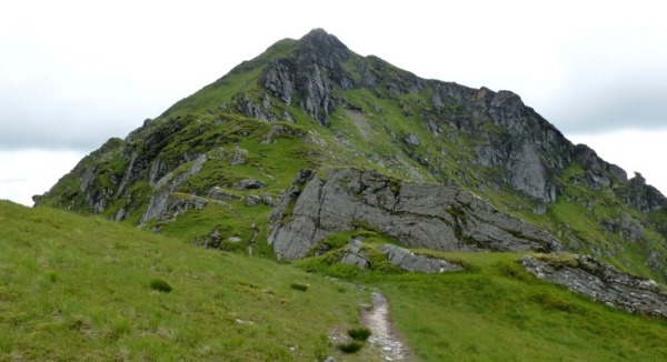
I remember feeling confined to lower hills during most of the cold spring and wet summer of 2015. Yet my database reports that I surveyed 418 summits, 30 alternative summits, 347 cols and 13 alternative cols in 2015. That does seem a lot. No wonder it took me so long to finish decorating the spare room. Reporting all these results would fill half the magazine, so I will just mention the more interesting findings, starting with those within five metres of the critical value.
| Sect | Name | Height | Drop | Grid reference | Status |
| 21A | The Bochel | 491.2 | 154.9 | NJ 23250 23256 | Unchanged |
| 07A | Crock | 553.9 | 154.3 | NO 22620 63254 | Unchanged |
| 07B | Cairn-mon-earn | 378.5 | 151.7 | NO 78266 91924 | Unchanged |
| 18B | Glas Bheinn | 635.3 | 151.4 | NM 93950 75775 | Relocated |
| 24A | Beinn Bhragair | 261.6 | 150.9 | NB 26679 43268 | Unchanged |
| 01A | Creag Gharbh | 637.4 | 150.8 | NN 63231 32728 | Unchanged |
| 13A | Sithean Mor | 383.0 | 150.8 | NG 83596 74013 | New Marilyn |
| 27B | Kirriereoch Hill | 786.8 | 150.2 | NX 42089 86951 | New Marilyn |
| 27C | See Morris Hill | 240.0 | 150.0 | NX 90291 77957 | Marginal |
| 10D | Beinn Gharbh | 895.3 | 149.5 | NM 88205 87659 | Unchanged |
| 19C | Stob na Boine Druim-fhinn | 658.3 | 149.4 | NN 16879 02536 | Demoted |
| 19C | Cruach Bhuidhe | 548.3 | 149.1 | NN 12523 94705 | Unchanged |
| 41 | Swyre Head | 206.6 | 148.3 | SY 93415 78467 | Demoted |
| 28B | Fanna Hill | 514.6 | 148.1 | NT 56974 03198 | Unchanged |
| 34B | High Spy | 653.1 | 147.8 | NY 23406 16227 | Unchanged |
| 04B | Beinn Eilde | 674.0 | 147.3 | NN 56353 85040 | Unchanged |
| 11A | Carn Bad a'Chreamha | 633.2 | 146.8 | NG 92576 26459 | Unchanged |
| 31B | Gilwern Hill | 440.6 | 146.8 | SO 09895 58290 | Unchanged |
| 05A | Glas Mheall Mor | 829.3 | 146.7 | NN 56337 67301 | Unchanged |
| 19A | Meall a'Chaise | 146.7 | 146.7 | NM 75288 17906 | Unchanged |
| 16E | Cnoc na Sroine | 398.3 | 146.4 | NC 25435 12858 | Unchanged |
| 03C | Ben Inverveigh | 637.5 | 146.4 | NN 27123 38200 | Unchanged |
| 24A | Mullach Breac Mhalasgair | 172.2 | 145.7 | NB 30142 16665 | Unchanged |
| 19A | Beinn Dearg | 483.3 | 145.5 | NN 02425 05018 | Relocated |
| 27B | Garleffin Fell | 429.6 | 145.2 | NX 34951 98900 | Unchanged |
| 14A | Carn nam Buailtean | 391.8 | 144.9 | NH 00819 87251 | Unchanged |
The table shows that status changes are relatively rare, as most surveys of marginal hills confirmed what we thought we already knew. The summit of Cairn-mon-earn has such a monstrous cairn that it was impossible to identify the natural summit. Thankfully, the col turned out to be well below the road and clear enough of trees to be surveyable, and the outcome was not dependent on summit cairn uncertainty. It was also pleasing to see other endangered marginals survive, including two hills not listed in RHB, Beinn Bhragair and The Bochel. The highest point of Glas Bheinn turned out to be next to the trig pillar, not the 636m point further west shown on OS maps.
The promotion of Sithean Mor was no surprise in such an undulating area, with no spot height at the critical col. I dismantled the summit cairn and found that there was natural rock within it, so that was worth doing, though it would have been promoted anyway without that extra 20cm. I built a smaller and neater cairn after I had finished collecting data.
The promotion of Kirriereoch Hill was hardly unexpected either, with the OS map showing two 786m spot heights on a large summit plateau. The highest point turned out to be a smooth rock to the south of the summit area - more satisfactory than either of the cairns, with no need for cairn reconstruction. The col was reasonably well defined with only a few cm margin for error, so I do not think a resurvey is necessary, though the drop is only 150.2m. Conditions were good and the data quality high.
The other promising candidate for promotion was Beinn Gharbh, a fine hill in a great location between Loch Morar and Glenfinnan. The awkward logistical problem was solved by a boat trip to Oban bothy, a walk over the undulating ridge from Cruach Bhuidhe, via Sgurr an Ursainn and its tops, then over Beinn Gharbh, Sgurr nan Coireachan and Meall an Tarmachain. The scheduled rendezvous in Glenfinnan did not quite work out, as the driver of the pick-up van was delayed by darkness on the awkward side of the path from Meoble, but the late train back to Morar and a starry walk alongside the loch completed a satisfying circuit. The Beinn Gharbh col played its part ok but the summit turned out to be lower than mapped, so the drop stalled at 149.5m. I am pleased that the result was not closer, as it means that a resurvey is not required.
None of the other Submarilyns really threatened the 150m mark, but I had the pleasure of visiting several challenging cols.
I had a bit of luck with Fanna Hill and Garleffin Fell, as trees at both col areas had been felled, making surveying feasible. I was able to drive fairly close to the Garleffin Fell col, but it still was not easy identifying or reaching the optimum survey point. It was a bleak spot on a bleak day, but being able to wait in the car during data collection made a big difference to the degree of miserableness.
The demotion of Stob na Boine Druim-fhinn was hardly a surprise as it was always a marginal Marilyn. There is a trig pillar on top so there was little chance of the summit being higher than 658m. The OS map shows the 510m contours at the col to be close together, so the key question was whether this narrow col area was flat. It turned out that it is, so there was no scope for finding the two metres necessary for it to retain its status. John Barnard surveyed the other demotion, Swyre Head, with a new surveying assistant. The result was satisfying in that it was conclusive and not dependent on the nature of the summit. The top of the tumulus is only 206.6m, not 208m as shown on some OS maps, and so it does not qualify as a Marilyn either with or without the tumulus.
See Morris Hill was chosen as an easy hill to survey on my way south on a dreary November day, but it was not quite as easy as I had hoped. The summit was easy enough and the col is at a road, but it turned out to be underneath a hedge and a large tree. This meant that I had to set up the survey point across the road from the tree and measure the offset from survey point to col. This increased the estimated margin for error on the ground to 15cm and the overall uncertainty to 20cm. I hoped that the result would be clear-cut but it was not. The drop was surveyed as 149.90m, giving a range from 149.7m to 150.1m. I decided that this was not good enough evidence to justify demotion, so it remains a Marilyn. I am not inclined to go back. If I did, I might be able to get a slightly more accurate result but probably not a definitive one, so it will most likely remain a Marilyn for the foreseeable future.
Apart from checking status, the other main motivation for surveying is to identify or confirm summit locations. This generates nervousness amongst some baggers in the vicinity of the wall. Most of them are now aware of the diminishing threat posed by marginal Submarilyns but perhaps less aware of possible summit relocations. In the interests of promoting peace of mind, it is worth reporting on those summits that have been confirmed as well as mentioning the few that have moved:
| Sect | Name | Height | Drop | Grid reference | Summit status |
| 01C | Cruach Ardrain | 1045.9 | 549 | NN 40926 21215 | Unchanged |
| 09B | Meall an Tarsaid | 492.3 | 154.7 | NH 49157 13065 | Relocated |
| 09B | Creag Bheag | 486.95 | 159 | NH 74598 01752 | Relocated |
| 10C | Meall Blair | 656.4 | 213 | NN 07741 95045 | Unchanged |
| 17C | Ben Meabost | 345.6 | 232 | NG 53655 15952 | Unchanged |
| 17C | Sgurr nan Caorach | 281.2 | 216 | NG 59372 03010 | Unchanged |
| 18B | Meall nan Damh | 723.4 | 344 | NM 91947 74496 | Unchanged |
| 19B | Cruach Lusach | 466.8 | 280 | NR 78600 83215 | Unchanged |
| 19C | Beinn an Lochain | 901.7 | 640 | NN 21803 07893 | Relocated |
| 19C | Cruach nam Mult | 611.2 | 282 | NN 16816 05637 | Relocated |
| 24A | Guaineamol | 404.9 | 167 | NB 26046 13398 | Unchanged |
| 27C | Green Hill | 588.0 | 158 | NS 86250 12540 | Unchanged |
| 28B | Turner Cleuch Law | 551.0 | 179 | NT 28741 20447 | Unchanged |
Those who made a return visit to Sgurr nan Caorach will be pleased to learn that it was worthwhile. I even checked the drop from the old summit (the trig pillar), which turned out to be 29.8m, so it remains a Stump. Green Hill was Chris Watson's 600th Marilyn, so perhaps he will be pleased to learn that it is 0.8m higher than Stood Hill.
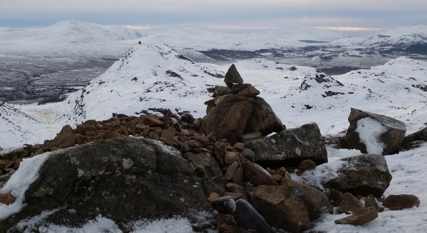
Beinn an Lochain (photo: Alan Dawson)
Beinn an Lochain is the sort of hill where you tend to visit both summits, as long as you can see them. Anyone who can only remember going to the ugly sprawling cairn in poor visibility will I assume be delighted to have the incentive to climb the hill again on a better day. It is very near the road but I found it a lot steeper than I remembered.
I was pleased to get a final answer for Meall an Tarsaid (in March 2016). It becomes the only Marilyn to have moved three times (Baystones also moved three times but is no longer a Marilyn). The survey required the removal of one large cairn and most of another to be sure of the outcome. The south top is 0.4m higher than the north top, which is shown as 493m on OS large-scale mapping but is only 491.7m. I built two smaller neater cairns when I had finished.
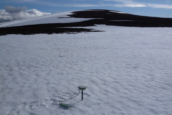
Creag Bheag near Kingussie presents more of a problem but I suppose I should report my findings. I went there on a frosty day in December, when my studded footwear was useful even in the icy car park. The OS map shows three 487m spot heights but I could only remember having been to one of them before - the one where the obvious path leads to the obvious cairn. One of the problems of winter surveying is trying to avoid hypothermia but here I discovered another problem - trying to dismantle a cairn that is frozen together. I eventually managed it but it took a lot of effort with gloves and wellies. I was reasonably confident that the rock under this cairn would remain the official summit but I was wrong. Both the other summits turned out to be slightly higher:
| Creag Bheag North | 486.96 | NH 74598 01752 | Rock north of cairn |
| Creag Bheag Central | 486.61 | NH 74547 01619 | Rock next to new cairn |
| Creag Bheag South | 486.94 | NH 74483 01434 | Rock north of cairn |
This result is very inconvenient. It appears that I visited the top of a Marilyn that I probably had not been to before. The summit has moved, but I don't know whether it has gone north or south. I will have to go back on a warmer day and have another look for it. A further complication is that the north summit has a cairn and a rock a little further north. I only surveyed the rock and didn't remove the cairn. There is a limit to what you can do on a freezing December day. The cairn on the south summit is clearly lower than the nearby rock.
The OS map is completely correct, as all three summits are almost the same height. If you have climbed the hill you have clearly had your head above the highest point, but the summits are not close together. The south summit is almost 300 metres from the central one and looks quite separate. It may or may not be the top, as 2cm is neither here nor there. Another case for the dubious bags committee to consider.
Creag Bheag central summit and view to south summit (photo: Alan Dawson)
Lots of surveys so only the most marginal or interesting results are reported here. Thanks to GJ Surveys for the decisive result for Gau Graig.
| Sect | Name | Height | Drop | Grid reference | Status |
| 01A | Tir Eilde | 630.1 | 100.0 | NN 83081 42010 | Unchanged |
| 02B | Meall a'Chail | 757.6 | 99.4 | NN 43682 40298 | Subhump |
| 14A | Glas Mheall Liath | 960.4 | 32.4 | NH 07770 84100 | New Simm |
| 07A | Carn Ait | 864.6 | 32.0 | NO 14289 73412 | New Simm |
| 06B | Carn Bhac South Top | 817.6 | 30.5 | NO 04216 80941 | New Simm |
| 09B | Carn na Criche | 875.8 | 33.1 | NH 57663 00898 | Unchanged |
| 10A | Sgurr Mor Near West Top | 614.1 | 31.4 | NG 87590 07920 | Unchanged |
| 27B | Caerloch Dhu | 659.4 | 30.6 | NX 40034 92011 | Unchanged |
| 07A | Carn Chomh-Stri | 715.8 | 30.0 | NO 13778 71983 | Marginal |
| 06A | Beinn Bhreac NE Top | 844.6 | 29.8 | NN 87323 83049 | Marginal |
| 06B | Blath Bhalg West Top | 635.8 | 29.5 | NO 01403 61056 | Unchanged |
| 14A | Mullach Coire Mhic Fhearchair East Top | 977.8 | 29.4 | NH 05625 73390 | Unchanged |
| 01C | Creag a'Phuirt | 733.5 | 29.2 | NN 40577 23739 | Unchanged |
| 10A | Druim Fada East Top | 649.9 | 29.0 | NG 90225 08528 | Unchanged |
| 06A | Leachdann Feith Seasgachain |
782.9 | 29.0 | NN 91446 81463 | Unchanged |
| 06B | Carn Torcaidh | 805.6 | 28.6 | NN 94077 73725 | Unchanged |
| 07A | Crow Craigies South Top | 871.9 | 28.6 | NO 22971 79025 | Demoted |
| 03B | Stob Coire nam Beith | 1106.9 | 28.1 | NN 13897 54600 | Demoted |
| 19C | Beinn Lochain East Top | 643.4 | 26.2 | NN 16483 00337 | Demoted |
| 30F | Gau Graig | 683.7 | 25.4 | SH 74373 14023 | Demoted |
| 10A | Sgurr Mor Far West Top | 597.6 | 38.2 | NG 86938 08265 | Demoted |
The three promotions and five demotions bring the current number of Simms to 2526. Sgurr Mor Near West Top had been promoted based on replicated altimeter readings, and Carn na Criche based on map research, so it was satisfying to see both of them confirmed as Simms. Carn Chomh-Stri was surveyed as having 29.9m drop but it survives for the time being as the col is in an area of soft wet peat and so is inherently unstable. I may go back there in drier conditions and try again. The most frustrating survey was that of Beinn Bhreac NE Top. In mid April, its critical col was still under deep snow. I did my best but the result is inconclusive and the status therefore unchanged. This hill is a long way from anywhere, so I doubt if I will be back.
Beinn Bhreac NE Top col, with Beinn Bhreac behind
Tir Eilde was surveyed as having 99.97m drop, which was rounded up to 100.0m and so it just about survived as a Hump, but Meall a'Chail did not. The most disappointing result was perhaps that for Carn Torcaidh. This is a superb shapely summit in a wonderful location, reachable via a lovely grassy ridge from Glen Tilt. Perhaps it is no bad thing that it will remain in Subsimm obscurity.
I freely admit that I was not in favour of these hills being added to DoBIH and Hill Bagging. It seemed to me unnecessary and taking things too far to add P20s to the large number of six-hundred metre summits already listed. I also thought that below 900m the list was too uncertain and inaccurate to warrant inclusion. On the other hand, there are over 800 points included in DoBIH that have less than 20m drop, so these are by no means the least significant set of hills. Anyway, they were added and baggers are logging them, and they have been consolidated into the category of Subsimms (hills over 600m with 20-29.9m drop), which has given them a more coherent status. Several of them have no recorded ascents. I have now taken the view that as these hills are listed then I might as well try to make the list as accurate and complete as possible. This is a huge task and has low priority, but it is always satisfying to discover a new hill, and in 2015 I found 11 new Subsimms. Perhaps it was a not such a bad move to include them after all. Some of them are more obvious on the ground than on the map, and leapt in from nowhere with drops of up to 27m, e.g.
| Section | Name | Height | Drop | Grid reference |
| 01A | Meall Reamhar | 616.9 | 27.5 | NN 61477 29237 |
| 02A | Beinn Eagagach West Top | 657.9 | 26.3 | NN 85042 56363 |
| 06B | Creag Dhearg | 663.8 | 24.0 | NN 99139 77645 |
| 02A | Sron Sitheag | 736.3 | 23.4 | NN 46873 46579 |
| 10A | Druim Fada West Top | 639.7 | 23.4 | NG 88583 08076 |
There are some good hills hidden way in these nether regions. Some have added to the enjoyment of a day in the hills and some have not. I was pleased to finally climb and measure the pinnacles on the ridge east of Bidein a'Ghlas Thuill:
| 14A | Bidein a'Ghlas Thuill East Top | 1042.7 | 23.2 | NH 06997 84306 |
| 14A | Bidein a'Ghlas Thuill Far East Top | 1002.4 | 19.7 | NH 07156 84250 |
Even though the weather was poor, these peaks looked suitably atmospheric in the swirling mist. They turned out to be fairly easy to climb up and down. Once a hill has been listed, it seems impossible to get rid of it, so strange people end up doing deleted tops. Bidein a'Ghlas Thuill Far East Top has now been relegated to Unclassified status, but you can still log it. I have details of several other Uns that are not on Hill Bagging - they are Unclassified Uns, lurking like dark matter outside the known hill universe. There will always be more Uns out there, including several In Uns, so it is probably best not to attempt to bag all the Uns in a section. Both Meall an Tarsaid summits are listed, so when the Un becomes the new Marilyn, anyone who has not logged it may lose one from their Marilyn total. So it goes.
