
In 2013 we identified one new Marilyn south of the Scottish border to add to the two Alan Dawson identified in Scotland. The Submarilyn Mynydd Anelog at the western end of the Lleyn peninsula in north Wales had been on our radar for several years. So on 12 July we finally managed to organise this survey. On a beautiful warm sunny day (made a nice change), we were joined by Chris Watson and Jeff and Enid Parr. In fact everything went well that day. The farmer who owned the land at the bwlch was very kind and accommodating. He gave us permission to drive our cars down through the field to the bwlch, having transferred his livestock out of the field so we would not be pestered by inquisitive bullocks. The summit is a glorious viewpoint too, and while the Leica GNSS unit was collecting summit data, we were able to admire the Lleyn peninsula in more detail while sunbathing. Bardsey Island enticed me as its summit still remains my last Marilyn in Wales.
The highlights for us in 2013 were the surveys we carried out in September on Skye, where we measured both the Bhasteir Tooth and Knight's Peak. The Munro Society commissioned us to survey the Bhasteir Tooth but Knight's Peak had been on our agenda for a long time. There had always been controversy about this one when the SMC reclassified it as a Munro Top based on a new photogrammetric measurement of 914.95m from Ordnance Survey. Obviously this was always going to be a close call, but another photogrammetric measurement carried out in our presence when we visited OS headquarters in Southampton during December 2009 gave a height of 914.5m. Having coordinated the SMC, Munro Society, Alan Dawson etc, we allocated a week in the middle of September to complete these two surveys, on the assumption that the number of days during which surveys would be practically possible would be a low percentage. Fortunately the weather was not too unkind and the work was completed successfully. Our thanks went out particularly to Andy Nisbet and Noel Williams of the SMC who guided the pensioners' survey party, average age about 65, safely around the obstacles of the Skye Cuillin. It was a great week and the survey resulted in a new height of 914.24m and the reclassification of Knight's Peak, which was subsequently announced on BBC Scottish television. The east peak was found to be 12cm lower at 914.12m.
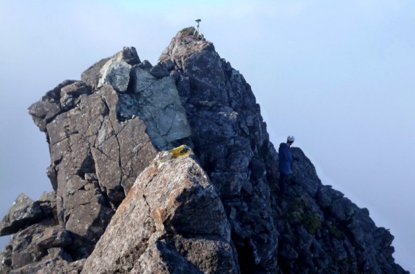
Graham Jackson below Knight's Peak summit (photo: Alan Dawson)
One hill that pushed us to the limits of surveying was Thack Moor in the northern Pennines. We have been working ever since we started surveying in 2006 on establishing a definitive list of hills in England and Wales (Nuttalls and Hewitts) over 609.60m. Thack Moor has a trig point on the summit area and the OS database gives the flush bracket height as 609.60m. So as flush brackets are usually quite accurate and are also usually about 0.3m higher than the surrounding ground, we thought there would be little chance of this hill making it over 609.60m. We would either have to find natural ground higher than the flush bracket (summit photos did not seem to suggest this) or the flush bracket height to be incorrect by more than 0.3m.
On 22 August 2012 our curiosity got the better of us and we surveyed Thack Moor. After taking detailed measurements on both sides of the dry-stone wall that crosses the summit, we found that the highest natural ground was 0.295m lower than the flush bracket, so the chance of this hill being over 2000 feet looked negligible. However, we were there so we collected our two-hour dataset and after processing found the result to be 609.645m, so 4.5cm above 609.60m. As this was much too close to be definitive in our view, we asked our contact at the OS for advice. 'Go back and collect another four hours of data' was the response, and just what we wanted to hear. Well we did, on 3 March 2013, accompanied by Bob Smith, who runs the Grough website, with his new video camera. So we were going to be the guinea pigs for movies on his website.
We repeated the survey from scratch, even to the location of the highest point, so that we would have two independent datasets to compare. Four hours is a long time to stand around on a hill top, but Bob was brilliant in keeping us going in the cold with anecdotes. After processing, the result was calculated to be 609.625m, even closer to 609.60m but still just above it. Finally the OS took our datasets, used their definitive Bernese software to process them, and computed the average height to be 619.62m, with the two independent datasets only differing by 0.001m. The measurement uncertainty given by Ordnance Survey was +/-2cm so Thack Moor was officially declared as an English mountain. I could not claim accuracy to this level using our commercial processing software. We were pleased with our perseverance and with the support given us by Ordnance Survey.
Another interesting 'commission' arose when we had a phone call from a guy called Howard Mann. He is the ex-CEO of McCain's Foods and has been a well-known and important figure for a long time in the food industry. He is writing a guidebook to the county tops of England and Wales, scheduled to be on sale by March 2014, and was interested in nailing the county top of the Vale of Glamorgan.
At that time the Database of British and Irish Hills was citing Lillypot, but Howard was not happy with this as the summit is crowned with a man-made covered reservoir. He felt that Tair Onnen was a more likely candidate but of course had no way of knowing unless accurate measurements were taken. This turned out not to be that simple, as detailed study of the OS 1:25000 map showed at least eight other contenders, and to be thorough all would need to be surveyed. It made a change from high hills to be surveying for summits 1m lower than my back garden and rather like it. After two visits and three days work, we arrived at the answer, which no doubt pleased Howard as it gave him the answer he wanted.
| Section | Name | Height | Drop | Grid reference | Outcome |
| 2A | Meall Chomraidh | 466.2 | 150.9 | NN48395566 | Confirmed Marilyn |
| 17B | Bhasteir Tooth | 917.2 | 22 | NG46512526 | Confirmed Munro Top, new Submurdo |
| 17B | Knight's Peak | 914.2 | 44 | NG41782541 | Reclassified from Munro Top to Corbett Top |
| 30A | Moel Tryfan | 429.0 | 102.6 | SH51535619 | Confirmed Hump |
| 30A | Mynydd Anelog | 191.4 | 151.0 | SH15192722 | New Marilyn |
| 30B | Foel Lwyd | 600.1 | 51 | SH72047232 | Confirmed Sim |
| 30B | Tal y Fan | 610.0 | 186 | SH72947265 | Confirmed Hewitt and Nuttall |
| 30C | Coed Hyrddyn | 232.4 | 102.0 | SJ20034394 | Confirmed Hump |
| 30C | Moel y Waun | 411.9 | 99.1 | SJ16845343 | Confirmed Subhump |
| 30D | Moel y Gyrafolen | 536.8 | 30.1 | SH67213529 | Confirmed Dewey |
| 30D | Ffrith y allt-lwyd | 500.4 | 46 | SH79722961 | Confirmed Dewey |
| 32C | Mynydd Dinas | 258.1 | 152.5 | SS76149153 | Confirmed Marilyn |
| 32C | Lillypot | 136.2 | 22 | SO05917489 | Deleted Vale of Glamorgan County Top |
| 32C | Tair Onnen | 137.3 | 70 | ST03667398 | New Vale of Glamorgan County Top |
| 32C | Maes y Ward | 136.9 | ST034752 | Lower than Tair Onnen, not County Top | |
| 35A | Thack Moor | 609.62 | 58 | NY61164627 | New Hewitt and Nuttall |
