
After a nine-month gap from July 2012, my surveying resumed in spring 2013 and took off at the end of May, when a knee arthroscopy meant that I went looking for an easy roadside hill to hobble up and survey. This led to the promotion of Lamberton Hill (formerly known as Ayton Hill) near Berwick and renewed enthusiasm, so I ended up surveying 92 summits and 66 cols during the year. That's too many to report in full here, so I have summarised the results of Marilyn, Submarilyn and Hump surveys and only listed the changes arising from Sim surveys rather than all results. Surveys carried out in March and April 2014 are included along with those from 2013.
| Section | Name | Height | Drop | Grid reference | Outcome |
| 4A | Cruim Leacainn | 231.1 | 149.4 | NN 1666 8074 | Demoted |
| 8B | Creag an Dail Bheag | 863.0 | 211 | NO 1573 9815 | New |
| 8B | Carn Liath | 861.5 | 33.1 | NO 1648 9762 | Superseded |
| 27C | Killyleoch Hill | 239.7 | 151.6 | NX 8785 8203 | New |
| 28A | Lamberton Hill | 217.0 | 150.5 | NT 9444 5865 | New |
| 1A | Meall Reamhar | 617.8 | 154 | NN 9220 3326 | Confirmed |
| 1A | Birnam Hill | 403.8 | 171 | NO 0320 4017 | Confirmed |
| 1C | Creag Mac Ranaich | 808.6 | 213 | NN 5456 2556 | Confirmed |
| 2B | Meall Garbh | 1123.0 | 198 | NN 6443 4375 | Detwinned |
| 2B | Meall a'Choire Leith | 925.5 | 150.5 | NN 6124 4388 | Confirmed |
| 3B | Buachaille Etive Mor | 1021.4 | 532 | NN 2226 5425 | Relocated |
| 7A | Corwharn | 609.1 | 152 | NO 2886 6510 | Confirmed |
| 10A | Biod an Fhithich | 645.9 | 154.1 | NG 9508 1473 | Confirmed |
| 12A | Carn na Coinnich | 673.3 | 265 | NH 3245 5105 | Detwinned |
| 17E | Corra-bheinn | 704.9 | 317 | NM 5732 3218 | Detwinned |
| 17E | Beinn Chreagach | 378.6 | 194 | NM 5198 2169 | Pinpointed |
| 17E | Tom nam Fitheach | 275.4 | 180 | NM 4692 4844 | Pinpointed |
| 19C | Sgorach Mor | 602.1 | 429 | NS 0968 8499 | Detwinned |
| 26B | Uamh Bheag | 665.6 | 325 | NN 6911 1185 | Detwinned |
| 27C | Blackcraig Hill | 700.9 | 236 | NS 6476 0640 | Pinpointed |
| 28A | Sell Moor Hill | 423.8 | 152.4 | NT 4803 4446 | Confirmed |
| 31B | Caeliber Isaf | 353.5 | 169.5 | SO 2116 9341 | Pinpointed |
The newly discovered Marilyns took the total to 1557 at the end of 2013, the highest ever, though this was reduced to 1556 with the demotion of Cruim Leacainn early in 2014 - another hill that was not listed in RHB but added later.
Several of these surveys confirmed that the currently listed summit is higher, though by narrow margins in some cases:

Eskielawn summit survey, looking north toward Ben Tirran (photo: Alan Dawson)
The separation of six metres between Meall Garbh and An Stuc was surprising, and resulted from the OS giving a spot height of 1118m for a lower top on the Meall Garbh summit ridge and no height for the actual summit. The summit of An Stuc was found to be a large rock about 25 metres from the cairn.
The survey results for Carn Liath and Creag an Dail Bheag were reported to the SMC and Ordnance Survey. The response from the SMC was:
"the issue of 'heighting' has become rather a prickly one... many find the chopping and changing of the List a bit unsettling, so my personal view is to leave well alone. Official SMC policy is that if the OS accept a new height then we will change our lists accordingly".
The initial response from the OS was predictably dismissive, but after polite persistence the Customer Services department referred the matter to the OS technical team, who requested further information and then (having been sent a survey report detailing the methodology) offered to process the survey data themselves. The satellite data for this pair of hills has therefore been processed three times, by different software and personnel each time, with the following outcome:
Carn Liath:
861.49m by AD
861.48m by GJ Surveys
861.47m by OS
Creag an Dail Bheag:
863.03m by AD
863.04m by GJ Surveys
863.02m by OS
The impressive consistency of these results helps confirm confidence in the accuracy of the survey process. The OS reported that 'the height accuracy of the survey is in the region of +-0.05m'. They also reported that they will be changing their maps to show Creag an Dail Bheag as 863m and Carn Liath as 861m (861.47m rounded down). This may lead to a change to the official Corbetts listing in due course.
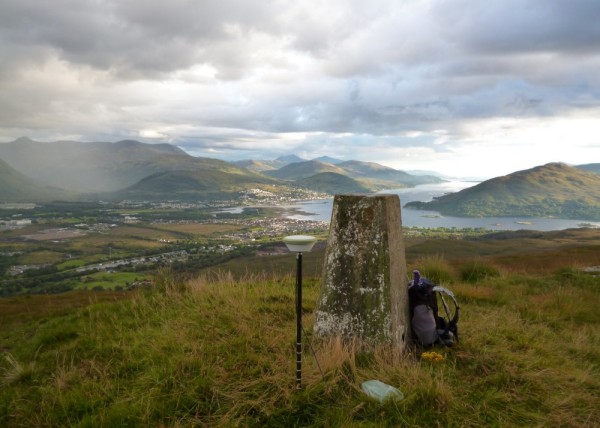
Fort William and Loch Linnhe from Meall Bhanbhaidh (photo: Alan Dawson)
| Section | Name | Height | Drop | Grid reference | Outcome |
| 3B | Stob na Doire | 1010.5 | 144.0 | NN 2075 5327 | Unchanged |
| 7B | Hill of Goauch | 337.1 | 148.7 | NO 6630 9418 | Unchanged |
| 10D | Meall Bhanbhaidh | 326.7 | 147.1 | NN 1157 7895 | Unchanged |
| 14B | An Coileachan | 923.9 | 148.3 | NH 2417 6802 | Unchanged |
| 16F | Sgorr Tuath | 587.5 | 149.0 | NC 1103 0749 | Unchanged |
| 17A | Baca Ruadh | 638.3 | 145.8 | NG 4748 5755 | Unchanged |
| 17E | Creach Bheinn | 491.6 | 146.7 | NM 4194 2912 | Unchanged |
| 17E | Cruach Torr an Lochain | 347.7 | 148.9 | NM 5640 4027 | Unchanged |
| 17E | Carn Mor | 343.1 | 146.3 | NM 3990 4886 | Unchanged |
| 27C | Blacklorg Hill | 680.9 | 148.0 | NS 6538 0423 | Unchanged |
| 28B | Cramalt Craig | 830.2 | 147.4 | NT 1684 2473 | Unchanged |
Hill of Goauch near Banchory posed particular problems, with several potential summit locations on a large tree-covered plateau, and a house surrounded by trees at the critical col. Two visits were needed to both summit and col, but the result was conclusive in the end.
The cols for Meall Bhanbhaidh, Cruach Torr an Lochain, Carn Mor and Blacklorg Hill were all difficult to survey owing to trees or extensive tussocks, with margins for error of up to 0.5m, but none of them were within a metre of promotion, so the results are regarded as conclusive.
| Section | Name | Height | Drop | Grid reference | Outcome |
| 1A | Milquhanzie Hill | 351.5 | 124 | NN 8944 2495 | New |
| 1A | Stroness Hill | 351.4 | 77 | NN 9131 2616 | Superseded |
| 2A | An Stuc | 1117.0 | 126 | NN 6389 4310 | Detwinned |
| 28A | Langlaw Hill | 368.7 | 100.2 | NT 1001 3822 | Confirmed |
| 28A | Knowes Hill | 373.9 | 100.6 | NT 4373 3831 | New |
| 28B | Lochcraig Head | 800.8 | 108 | NT 1666 1774 | Relocated |
| 28B | Bodesbeck Law | 664.2 | 101.3 | NT 1699 1040 | Reinstated |
| 30E | Foel Benddin | 541.9 | 98.7 | SH 8536 1650 | Unchanged |
Owing to the closeness of the height difference between Milquhanzie Hill and Stroness Hill, a second survey was carried out the day after the first, which confirmed the result beyond doubt.
| Section | Name | Height | Drop | Grid reference | Outcome |
| 1A | Sron Mhor | 648.4 | 32.4 | NN 6419 2724 | New |
| 1A | Creag Liath | 598.2 | 29.5 | NN 9136 3473 | Demoted |
| 1B | Leacann Amarach | 753.6 | 29.2 | NN 6158 1649 | Demoted |
| 1C | Meall Sgallachd | 707.0 | 28.8 | NN 5537 2598 | Demoted |
| 1C | Meall an Lochain | 661.7 | 30.4 | NN 5117 2371 | New |
| 17E | Cruachan Beag | 600.9 | 34.4 | NM 5782 3387 | Confirmed |
| 18A | Sgurr Dhomhuill Beag | 677.4 | 29.3 | NM 7438 7569 | Demoted |
| 28B | Swatte Fell | 729.9 | 36.3 | NT 1184 1138 | Relocated |
| 35B | Gragareth | 628.0 | 32.8 | SD 6888 7931 | Relocated |
The survey of Cruachan Beag on Mull confirmed that it is over 600m and also higher than nearby Maol Buidhe, which is only 599.7m.
Gragareth is the new county top of Lancashire, as Green Hill is 627.5m. A further 32 marginal Sims were surveyed in 2013 with no change in status: 17 hills were confirmed as Sims, and 15 as Subsims. One of those retaining its status, just, was Sgurr a'Bhasteir on Skye, with 30.06m drop, but it turned out to be 900.1m high, not 898m as mapped. Details of all surveys are available at www.rhb.org.uk
As well as the survey results, a few changes to the Sims list were made following further study of large-scale online maps:
| Section | Name | Height | Drop | Grid ref | Status |
| 9B | Carn na Criche | 876 | 31 | NH576009 | New |
| 10B | Sgurr a'Choire-bheithe East Top | 877 | c 31 | NG900012 | New |
| 11A | Suie Dhu | 615 | c 29 | NG999254 | Demoted |
| 12B | Sgorr na Diollaid Far West Top | 713 | c 28 | NH264359 | Demoted |
These changes bring the current number of Sims back down to 2530. The Sims Hall of Fame remains out of reach of most baggers, with no new entrants in 2013, leaving the table like this at the end of 2013:
| Ken Whyte | 2530 |
| Iain Thow | 2494 |
| Colin Crawford | 2325 |
| Andy Hyams | 2198 |
| Rob Woodall | 2058 |
In view of the huge effort required to join this select bunch, and in response to comments from keen baggers, I am still resisting lowering the threshold from 2000, but have decided to open up a corridor leading to the Simhof. The initial version of this at the end of 2013 was:
| Colin Donnelly | 1947 | Michael Earnshaw | 1654 |
| Alan Dawson | 1936 | Jim Bloomer | 1636 |
| Bert Barnett | 1797 | Richard Webb | 1613 |
| Alan Castle | 1763 | Graham Illing | 1586 |
| Neil Sandilands | 1710 | Gavin Theobald | 1586 |
John Ward became the latest entrant to the Sim corridor early in 2014, with Richard Speirs poised near the corridor entrance. Anyone else with over 1500 Sims in their bag should get in touch if they have not already done so. Or better still, use the hill-bagging.co.uk website to facilitate recording and retrieval of progress. Annual updates will be published online at www.rhb.org.uk.

