
No changes to the Marilyns last year - Garreg-hir was close but it still shaved in with a drop of 150.7m.
The surveying highlight would be the height measurement for the Fisherfield Munro, Beinn a'Chlaidheimh, which falls short of the 3000-feet mark by 0.4m. This was part of the heighting project carried out for the Munro Society. The Ordnance Survey are now putting the new height on their maps but the Scottish Mountaineering Club, which maintains the list of Munros, is still considering the result and as yet has not accepted the new height for its official list.
We found a new Dewey, Kirkby Fell, which made a nice change from all the deletions we have made to this list.
The survey for the highest point in Nottinghamshire caused a little stir locally. The council had reclaimed a slag tip called Silverhill and had enlarged it to become the highest point in the county. Our measurements showed that they had not added enough to the top and that a point on the Derbyshire / Nottinghamshire border near Newtonwood Lane was still higher.
All the remaining surveys resulted in the maintenance of the status quo or shifts in summit positions.
| Name | Height | Summit | Drop | Status | |
| 14A | Beinn Dearg Mor | 906.3 | NH03227992 | 564 | Still a Corbett |
| 14A | Beinn a'Chlaidheimh | 914.0 | NH06137756 | 266 | Demoted Munro? |
| 14A | Ruadh Stac Mor | 918.9 | NH01857565 | 167 | Still a Munro |
| 19B | Cruach Lusach | 466 | NR786832 | 279 | Summit confirmed |
| 28B | Beefstand Hill | 562 | NT821143 | 70 | Deleted Dewey: top is in Scotland |
| 30C | Bryn Alyn | 408.3 | SJ20085875 | 100.8 | Still a Hump |
| 30D | Craig yr Hafod | 533.6 | SH88884375 | 66 | Dewey (wrong height on OS maps) |
| 30E | Lledwyn Mawr | 526.0 | SH90502874 | 30.9 | Still a Dewey |
| 31A | Garreg-hir | 484.9 | SN99879792 | 150.7 | Still a Marilyn |
| 31B | Shadwell Hill | 497 | SO20398749 | Not a Dewey | |
| 31C | Esgair Gelli | 504.5 | SN77645777 | 28.2 | Not a Dewey |
| 32A | Fan Brycheiniog | 802.5 | SN82432206 | 423 | New summit position |
| 32A | Moel Feity | 591 | SN84862304 | 78 | Dewey summit identified |
| 32A | Cefn Cul | 562 | SN86062057 | 99 | Dewey summit identified |
| 33 | Housedon Hill | 266 | NT90213270 | 182 | Still a Marilyn (south top is the summit) |
| 34C | Wether Hill | 670 | NY45461630 | 15 | Nuttall (south top is the summit) |
| 34D | Lambrigg Fell | 339.6 | SD58689417 | 158.6 | Still a Marilyn |
| 35B | Kirkby Fell | 546.4 | SD87386353 | 31.1 | New Dewey |
| 36 | Chinley Churn | 457.0 | SK03698436 | 129 | Hump (new summit position) |
| 36 | High Billinge | 178.6 | SJ55476621 | 127 | Hump (replaces Hangingstone Hill) |
| 37 | Newtonwood Lane | 205.0 | SK45616064 | 45 | New County Top for Nottinghamshire |
The surveys of Cruach Lusach, Wether Hill and Beefstand Hill were carried out by Abney level, all others using differential GPS.
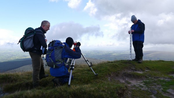
Surveying Fan Brycheiniog (photo: George Gradwell)
Just the two surveys so far, using a Leica RX1250 GPS, with no change in status of the relevant hills:
| Name | Height | Summit | Drop | Status | |
| 4B | Meall na Duibhe | 571.2 | NN22656532 | 149.1 | Still a Submarilyn |
| 28B | Fastheugh Hill | 501.5 | NT39332771 | 144.9 | Still a Submarilyn |
