
Arriving in John o'Groats we stopped for a coffee in an otherwise empty cafe. This was fortunate as the proprietor engaged us in conversation and advised us that the Pentland ferry from Gills Bay was much cheaper than the P&O ferry from Scrabster, which we had intended to use. The advantage of never booking a ferry in advance became apparent, as there was a saving of £60 on the return fare for a vehicle and two passengers.
Our plan on arrival in Orkney was to walk to as many island high points as possible, including all the Marilyns, in the ten days available. We duly made base camp on the site operated by the Kirkwall sports centre - cafe and all facilities, plus easy walking distance to the inter-island ferry terminal.
Over a couple of days we walked up the four hills on Mainland, between visiting various historical sites and finding the relatively rare oyster plant, a beautiful prostrate borage found on shingle beaches. Three of the hills had tracks well up, and even to the summit of Wideford Hill. The most southerly, Mid Hill, we approached from the south up a track leading to Gruf Hill, then an intermittent footpath towards Ward Hill, and finally a kilometre plod through deep heather.
Blotchnie Fiold on Rousay was an easy walk between ferries, and has a footpath over Knitchen Hill to the summit, and then on in a circular fashion through the nature reserve to Taversoe chambered cairn. This path is not shown on the 1998 Landranger map, but starts from the B9064 below Shingly Hill.
For Fitty Hill on Westray we started the walk along the coast from Kirbist (Scots lovage found here) then over Skea Hill to the summit, returning westwards to the coast, then south back to Kirbist. We stayed overnight at a very good and reasonably priced campsite with bunkhouse at Pierowall. The next day we crossed with our bicycles to Papa Westray, and after cycling to the north end we walked north along the east coast to Mull Head, returning over the 48m high point of North Hill. On the way we found flowering plants of Scottish primrose.
Taking the ferry to Hoy for the remaining three Marilyns, we started the walk for Cuilags from the north end of Sandy Loch and went straight up the steep hillside to the summit, then descended to a point well south of Sandy Loch and up to Ward Hill before returning down the west flank. We then went round to the Dwarfie Stane and traversed through the heather and up to the summit of Knap of Trowiglen, easily completing all three on the same day.
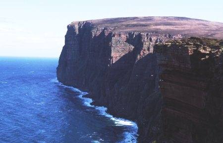
Cuilags, Hoy (photo: Richard Webb)
By careful planning of inter-island ferries we completed the high points (some quite low) of fourteen islands. The ferries were very cheap for foot passengers and bicycles, regardless of distance through the water. The islands are packed with historical sites, museums, interesting old mills etc. The museum on Rousay is particularly recommended. We were blessed in June with reasonably good weather for the whole stay.
